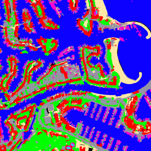
The OTB library and the interactive software Monteverdi were at the center of a workshop organized by the National Committee of Remote Sensing of Madagascar from November 17th to 20th, 2010.
The French Space Agency (CNES) in collaboration with the French Institute for Research and Development are helping to the development of the use of remote sensing data by getting access to images (Spot) but also by providing tools to manipulate these data.
In 2009, for the first course in Antananarivo, Monteverdi was developed. The software is based on OTB and gives access to lots of functionalities through an interactive and modular structure. It gets access to a wide variety of technical modules and takes advantage of streaming and multi-threading capabilities of the library. We received a lot of interesting feedback after the course, requests for the implementation of new functionalities grew steadily and so the development of Monteverdi continued during 2010.
On the other hand, Monteverdi is a “young” software which could be improved but it is a step to help the development of a pragmatic and interactive tool to manage the use of remote sensing data. A tutorial was just organised on this subject at the IGARSS conference in 2010 in Honolulu.
The second course in Antananarivo, two weeks ago, was the occasion to capitalize on concepts learnt in 2009 and was also the occasion to present new functionalities developed during the last 12 months. The courses covered a large scope of the main remote sensing processes available in Monteverdi. From basic operations to the practical use of the Change detection framework or of the optical calibration module based on the radiative transfer code 6S.
One more time Monteverdi proves its abilities as a support for technical courses because it can cover a large scope of the principal tasks needed by a user of remote sensing data. From geometric processing like the orthorectification module to Feature extraction, segmentation or supervised classification.
It also appears that some new modules added in 2010 get a lot of success and are a progress in the right direction. For example, the Band Math module which allows to perform generic mathematical operations between image layers.
Moreover, this kind of tutorials are also an excellent way to get immediate feedbacks and reactions about the software and to get a direct interaction with end users:
-Is there a module to perform Object based classification in Monteverdi ( notably for VHR data)? YES, have a look to the Object labeling module
-Is it possible to save/load process chain in Monteverdi? For now no, but we will work on it…
-Is it possible to apply a process to a masked region of the input image?
-Is it possible to remove results from the data tree in Monteverdi? NO (but it is feasible)
The vast majority of students’ questions or problems often point out really interesting feature requests and as a consequence are the beginning of the roadmap of the software.
There are also more general questions about the software:
-How to increase the ergonomy and the user experience of Monteverdi?
-How can we generalize the integration in Monteverdi of existing OTB filters for non developers?
-How to achieve a seamless integration and collaboration between OTB and existing Open Source tools?
One more time the course was also a proof of the value of Open Source principles: for example the combination of Open Data over Madagascar available through the Open Street Map project and open source software able to use it efficiently like Monteverdi.
The idea is not to believe in a “techno-utopia” where information technology could eliminate poverty and inverse difficult solutions. Information technology and Open Source software increase capabilities but are dependent on the fact that they need users which are ready and able to use them.
I hope that this event was as much as valuable for the students that it was fot me and for the future of OTB.
Soon a “Coming next” article about recent improvements in the collaboration between OTB and Quantum GIS…

One thought on “North-South cooperations with the Orfeo Toolbox : Pragmatic remote sensing in Madagascar”