Now that computer are connected to the internet and that tons petabytes of data are available, that would be a shame not to use all this for some processing. The development version of Monteverdi has just added the capability to get images from out of your box: tile map access.
Basically, it gets data which are provided as small image files to produce a big image of the area requested. The available source for now are open street map, landsat background provided by nearmap, and a hill shaded terrain model.
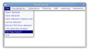
After launching Monteverdi, just pick up the tilemap import:
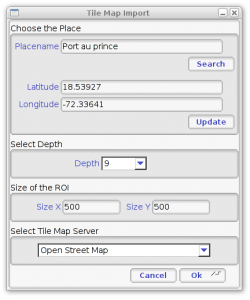
You can then choose your location, either by providing the latitude and longitude or if you have no idea of it, the name of the city, street, town, country, etc. Also pick up the level of zoom (0 is the entire earth, 18 is really zoomed in) and the size of the image you want as an output.
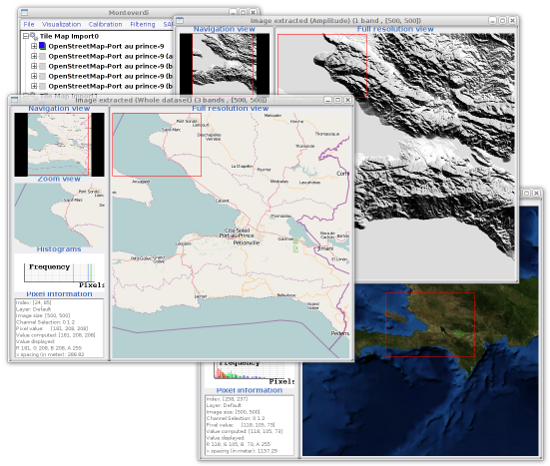
After that, you get some nice images that you can plug to the other processing algorithms available in Monteverdi:
This is still quite experimental so we are willing to get any suggestion on how to improve that. The tiles are kept locally in cache to minimize the network transfer when working repeatedly on the same area, but try to stay reasonable in term of how much data are requested…
Note that the stuff is working on both direction even if we illustrated only the part which is getting the image. The hill shading part is provided by the OTB server and all the tiles, several hundreds of thousand, have been generated by OTB. This behave (almost) like a standard writer, so tiling your own satellite images (with of without additional processing in between) should be just plumbing some filters together.


